IAP Glossary and Legend
Glossary
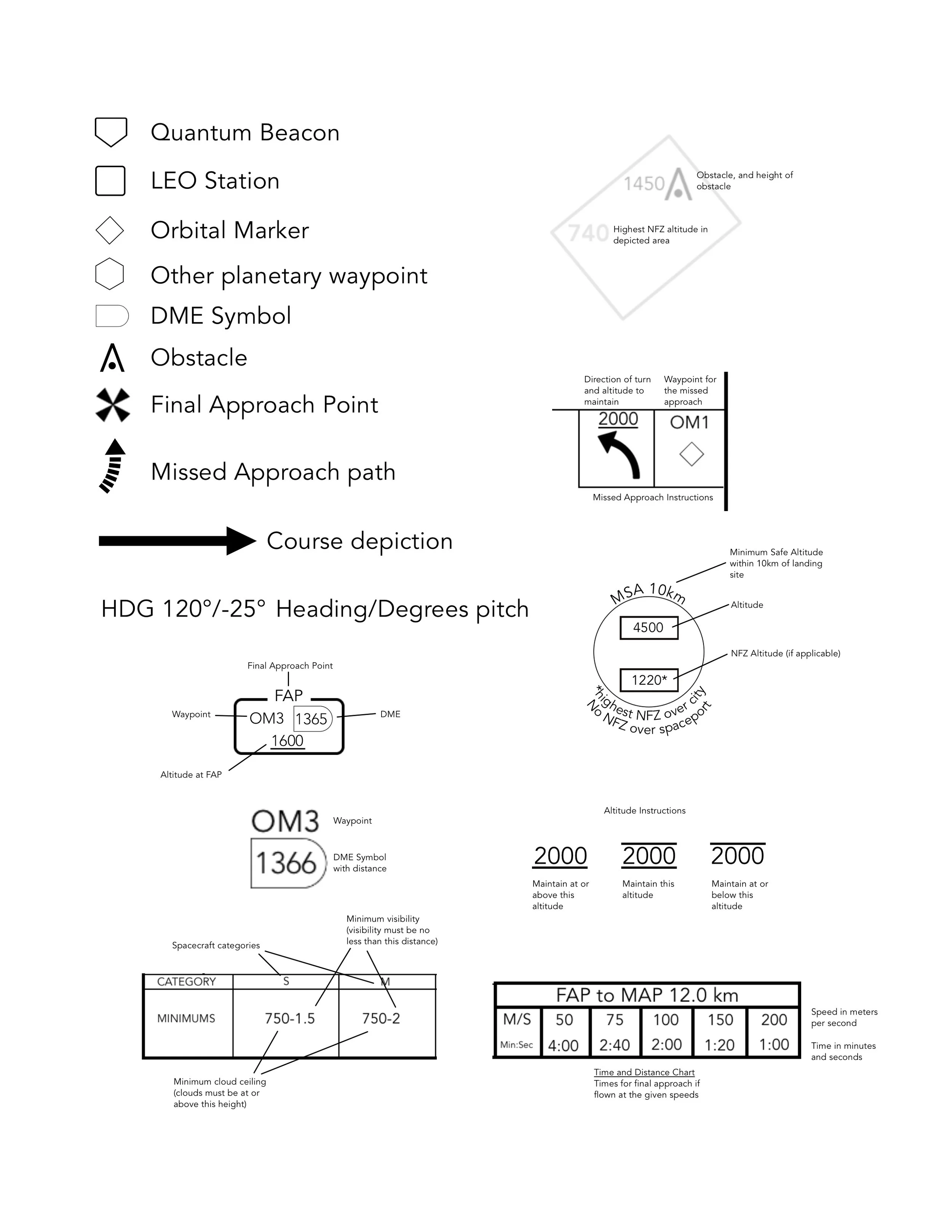
App Crs: approach course, the heading flown on final approach
CAT/Category: spacecraft category, corresponds to landing pad/hangar size for ship
DME: Distance Measuring Equipment, or as in this case, the distance to or from a navigational aid or waypoint
ELEV: field elevation
FAP: Final Approach Point, the point where final approach begins
Heading: compass heading, in degrees
Hangars: the number and type of hangars and/or landing pads available for use (note that not all pads or hangars may be available to the public)
IAF: Initial Approach Fix, the point where the approach procedure begins
MAP: Missed Approach Point, the point where the approach is terminated if the spaceport is not in sight
Min:Sec: Minutes/seconds
Minimums: the minimum weather conditions that must be present for the approach to be flown, expressed in cloud ceiling (in meters) followed by horizontal visibility (in km).
Missed Approach: the procedure flown when the instrument approach cannot be completed
M/S: meters per second
MSA 10km: the minimum safe altitude within 10km of the landing location
NFZ: No Fly Zone
No Fly Zone: an area or areas where flight is not permitted
OM: Orbital Marker
QBA Z/X/Y: Quantum Beacon Approach-the Z, X, or Y differentiates the procedures when more than one is available for a given location
QTA: Quantum Travel Altitude, the altitude at which quantum travel is possible
Quantum Beacon: the quantum travel waypoint for a given location
Sector: Part of a QBA-B approach, defined by headings towards the landing zone’s quantum beacon, in which safe descent altitudes are charted for the approach.
TOA: Top of Atmosphere, the upper limit of a planet or moon’s atmosphere (where the altimeter stops).
Legend